


Pix4D Mapper
- Brand: Pix4D
- Product Code: Pix4D Mapper
- Availability: In Stock
-
£304.62
- Ex Tax:£253.85
Available Options
Pix4D Mapper
The leading photogrammetry software for professional drone mapping
Capture
Capture RGB, thermal, or multispectral images with any camera or drone and import them to PIX4Dmapper.
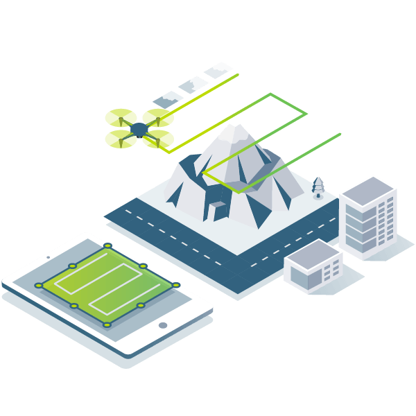
Photogrammetric Digitising
PIX4Dmapper's photogrammetry algorithms transform your ground or aerial images in digital maps and 3D models.
Seamlessly process your projects on your desktop using our photogrammetry software.

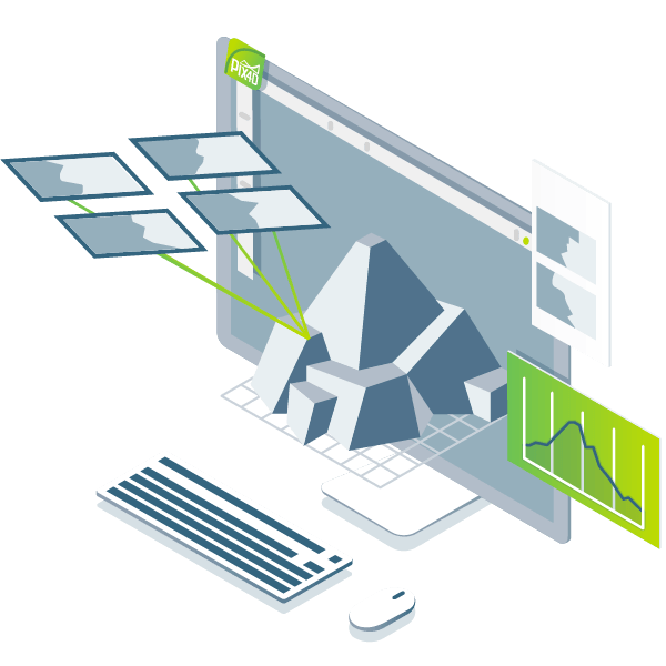
Control
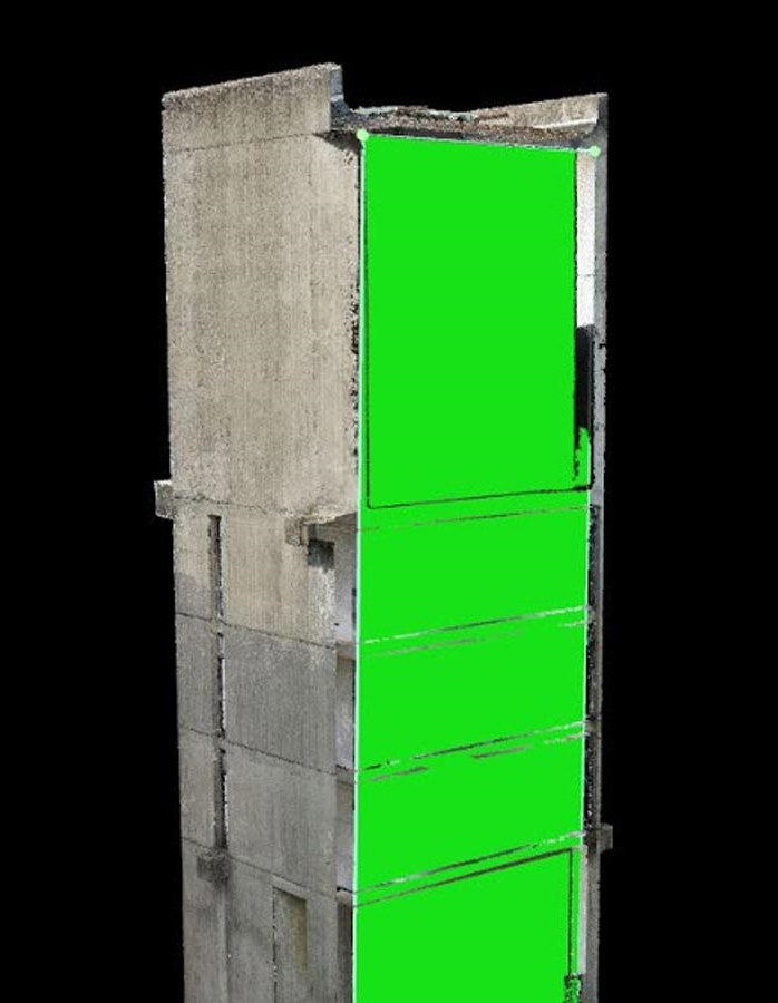
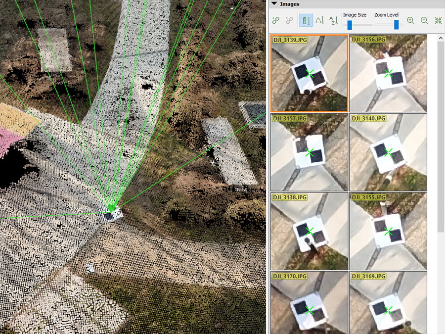
Use the power of photogrammetry in the rayCloud environment to assess, control and improve the quality of your projects.
Use the quality report to examine a preview of the generated results, calibration details, and many more project quality indicators.
Measure and inspect
Accurately measure distances, areas, and volumes

Photogrammetry solution to power applications across industries
Advanced data processing for precise results

Survey-grade results
Obtain results with sub-centimetre accuracy thanks to photogrammetric analysis.
1-2 pixel GSD in X, Y directions
1-3 pixels GSD in the Z direction
Complete control over your project
Define an area of interest, select processing options, add ground control points or edit point clouds, DSMs, meshes, and orthomosaics.
Your workflow, your choice
Use default templates for automatic processing of your projects, or create your own with custom settings for full control over the data and quality.
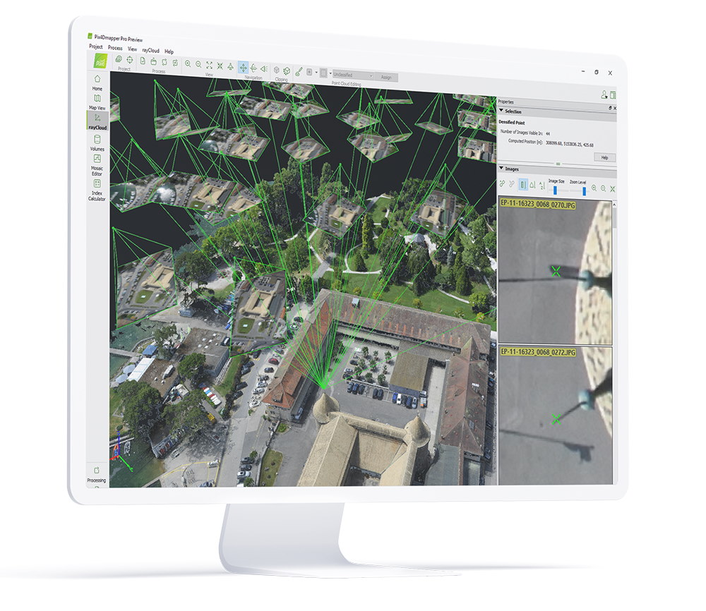
rayCloud - The power of photogrammetry software
A unique environment connecting your original images to each point of the 3D reconstruction to visually verify and improve the accuracy of your project.
Automatic point cloud classification
Distinguish objects with machine learning classification processes.
Flatten & smooth digital surfaces
Create surfaces to improve planarity or fill holes in critical areas.
Easily measure surface, distance & volume
Measure in 3D with a fully-adjustable base height.
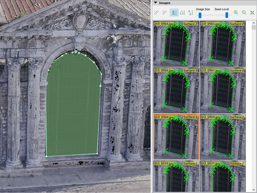
Control over the project accuracy
Annotate and edit 2D and 3D GCPs, check points, and MTPs with the highest accuracy, using both original images and 3D information at the same time.
Detailed quality report
Assess the accuracy and quality of your projects.
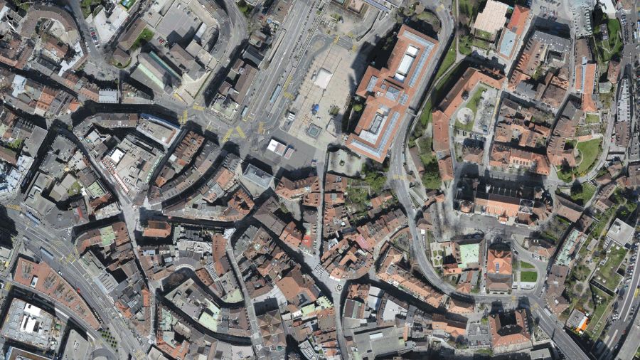
Photos first
Any camera. Any drone. Any imagery. As long as it's a .jpg or a .tif.
Generate high resolution outputs for any project and use case
Easily export your digital maps and models to industry-compatible formats for further analysis or reporting
Outputs Mapper can provide:
Colour point cloud
The colour point cloud uses RGB data from a raster for colourisation. Each point of the point cloud receives the RGB value of the raster pixel that has the same location.
Output formats:
.las, .laz, .ply, .xyz
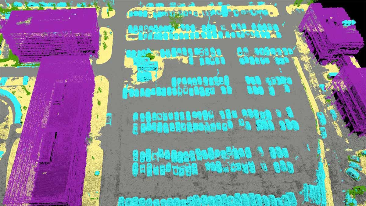
Classified point cloud
The point cloud is classified in 5 predefined groups: ground, road surface, high vegetation, building, human made object. The results of the classification are used for the DTM generation.
Output formats:
.las, .laz

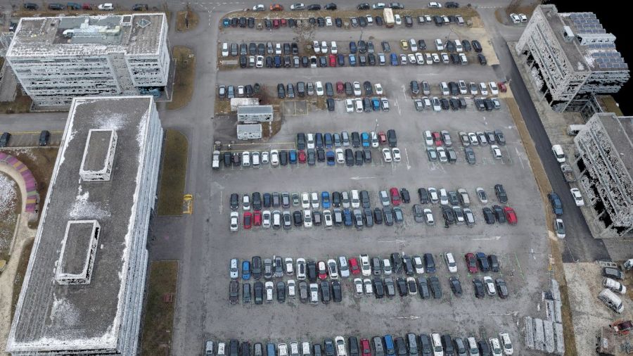
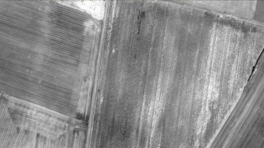
Orthomosaic
2D image map geometrically corrected such that the scale is uniform. Colour balanced to be visually pleasing.
Output formats:
GeoTiff (.tif), .kml
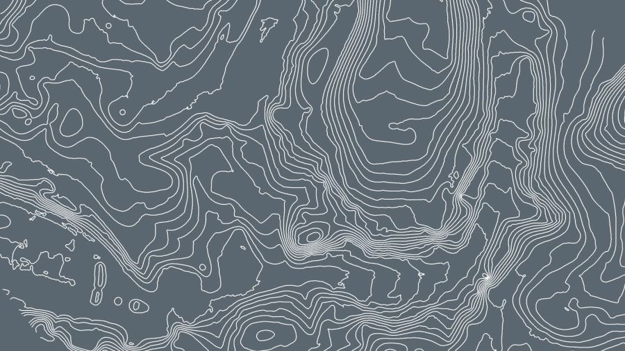
Contour lines
These are lines connecting points of equal elevation. They allow to better understand the shape of the land surface (the topography) on a map.
Output formats:
.shp, .dxf, .pdf
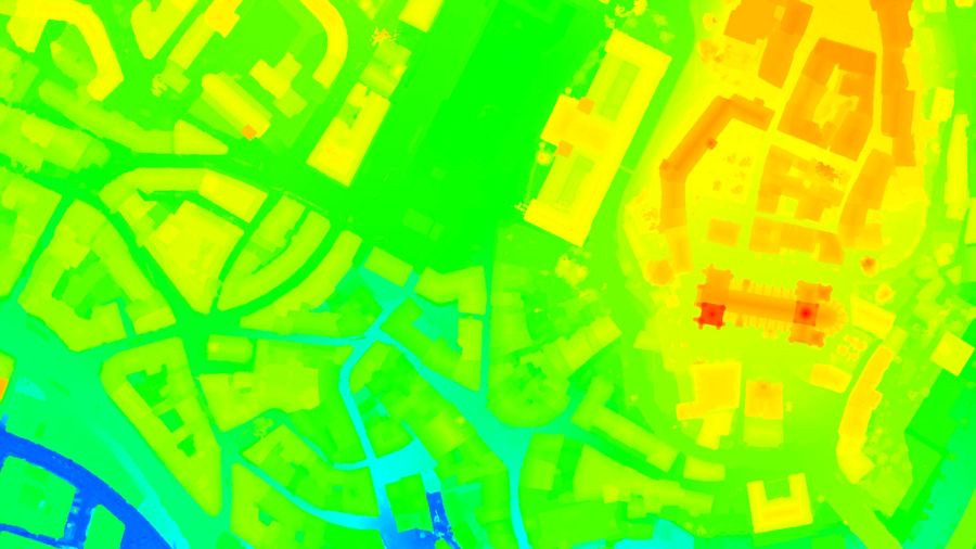
Digital terrain model (DTM), Digital elevation model (DEM)
2.5 D model of the mapped area after filtering out objects such as buildings, that contains (X,Y,Z) information but no colour information.
Output formats:
GeoTiff (.tif)
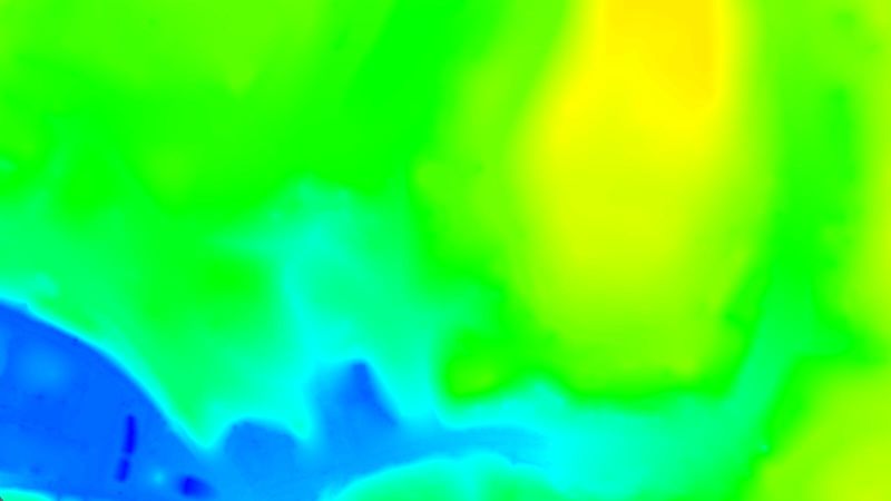
Digital surface model (DSM)
2.5 D model of the mapped area that contains (X,Y,Z) information, but no colour information.
Output formats:
GeoTiff (.tif), .xyz, .las, .laz
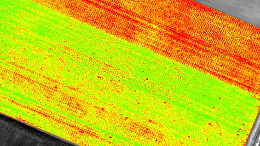
Index maps
Each index is associated to an index map. For each pixel on this map, the value of the pixel is derived from the associated reflectance maps.
Output formats:
GeoTiff (.tif), .shp
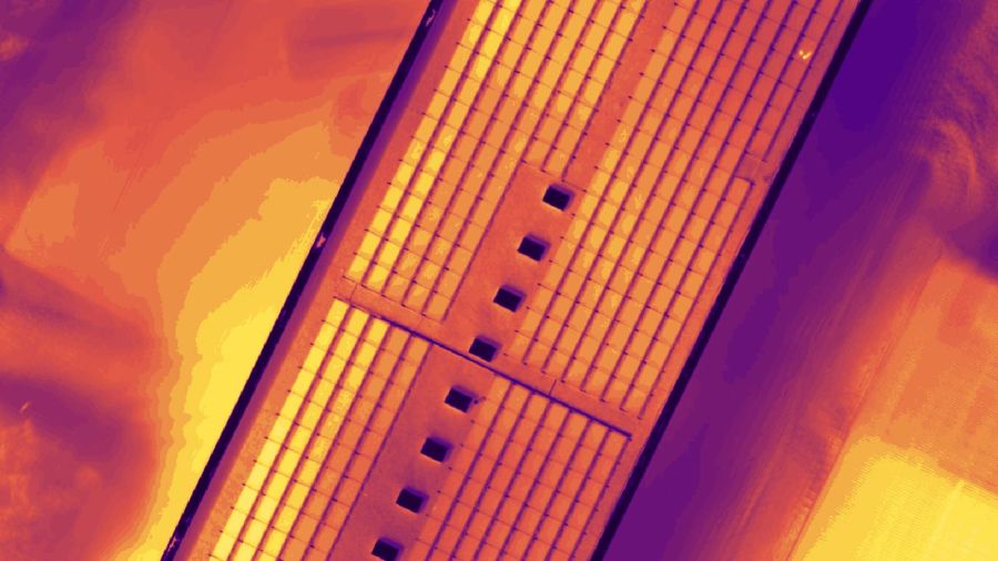
Thermal maps
Thermal maps are 2D maps displaying the thermal information from infrared imaging cameras for each pixel.
Output formats:
GeoTiff (.tif)
Reflectance maps
A reflectance map compiles the reflectance values of each pixel and geometry into a single function.
Output formats:
GeoTiff (.tif)
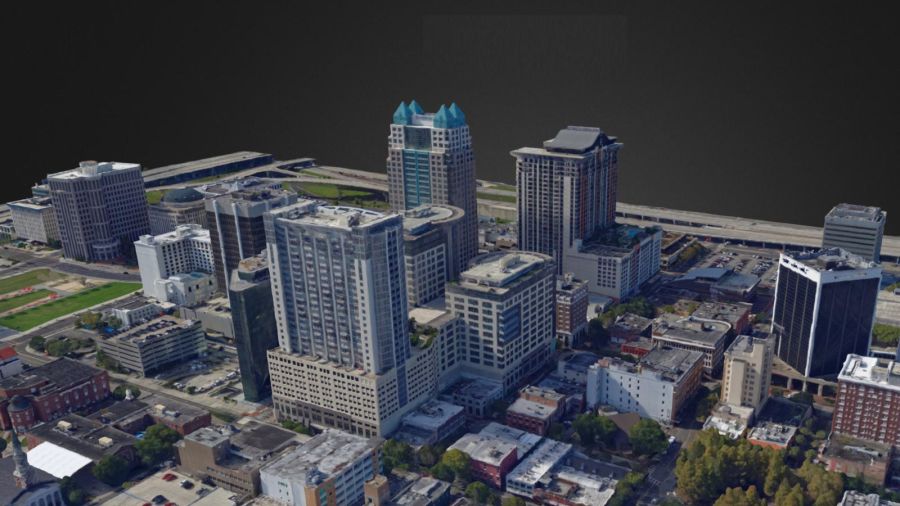
3D textured mesh
A representation of the shape of the model that consists of vertices, edges, faces and the texture from the images that is projected on it.
Output formats:
.ply, .fbx, .dxf, .obj, .pdf
What's Included?
Desktop application with floating license (use on up to 2 devices simultaneously)
Unlimited desktop processing and high-resolution outputs
Personal support and upgrades included during your subscription from Pix4D.
What happens when I buy this product?
You will be sent your product key in .pdf format within 1 working day.
Where can I redeem my product key to start using Pix4D Mapper?
You can redeem your key here: https://account.pix4d.com/redeem
You will need to have an account and be logged in.
What camera do I need to use this software?
Any camera/drone that you can take overlapping pictures with.
What are the requirements to run Pix4D?
Minimum
Windows 10 / 11.
CPU (Intel i5/ i7/ Ryzen 7).
GPU that is compatible with OpenGL 3.2. (integrated graphics cards Intel HD 4000 or above).
Small projects (under 100 images at 14 MP): 4 GB RAM, 10 GB HDD Free Space.
Medium projects (between 100 and 500 images at 14 MP): 8 GB RAM, 20 GB HDD Free Space.
Large projects (between 500 and 1000 images at 14 MP): 16 GB RAM, 40 GB HDD Free Space.
Very Large projects (1000 - 2000 images at 14 MP): 32 GB RAM, 80 GB HDD Free Space.
For larger projects take a look at PIX4Dmatic.
Recommended
Windows 10/11.
CPU quad-core or hexa-core Intel i9/Threadripper/Ryzen 9/.
GeForce GTX GPU compatible with OpenGL 3.2 and 2 GB RAM.
Hard disk: SSD.
Small projects (under 100 images at 14 MP): 8 GB RAM, 15 GB SSD Free Space.
Medium projects (between 100 and 500 images at 14 MP): 16GB RAM, 30 GB SSD Free Space.
Large projects (over 500- 1000 images at 14 MP): 32 GB RAM, 60 GB SSD Free Space.
Very Large projects (1000 - 2000 images at 14 MP): 64 GB RAM, 120 GB SSD Free Space.
For larger projects take a look at PIX4Dmatic.
High-end Build Components
For applications where low processing times and large datasets require the use of high-end workstations, there are high-end components that have proven to work better than others in most cases. An ideal high-end workstation provides balanced resources to avoid bottlenecks that slow the system down overall. Below are some of the components which have performed well with Pix4D.
CPU
Core i7 8700K (Good)
Ryzen 9 5950x (Better)
AMD Threadripper 3970X 32-core (Best)
GPU
NVIDIA GeForce RTX 2070 SUPER (Good)
NVIDIA GeForce RTX 2080 (Better)
NVIDIA GeForce RTX 2080 ti (Best)

A2 Certificate of Compete..

GVC Drone Training - Gene..

Parrot ANAFI Ai 4G Unlimi..
Pix4D Survey

Pix4D React

PIX4D Fields

Pix4D Matic