


PIX4D Cloud
- Brand: Pix4D
- Product Code: PIX4D Cloud
- Availability: In Stock
-
£61.28
- Ex Tax:£51.07
Available Options
- OR -
PIX4D Cloud
The online platform for ground and drone mapping, progress tracking, and site documentation| Standard 1 Month | Standard 1 Year | Advanced 1 Month | Advanced 1 Year | |
|---|---|---|---|---|
| Price | £50.98 | £611.11 | £309.75 | £3,097.52 |
| Credits | 20 | 500 | 100 | 2500 |
| Create accurate 2D maps and 3D models from images | Included | Included | ||
| Measure distances, areas, and volumes | Included | Included | ||
| Add annotations | Included | Included | ||
| Generate elevation profiles | Included | Included | ||
| Perform virtual inspections | Included | Included | ||
| Share with team and stakeholders | Included | Included | ||
| Track and document site progress with a visual Timeline | - | Included | ||
| Compare volumes over time | - | Included | ||
| Overlay design plans and maps | - | Included | ||
| Compare two image maps to see what has changed | - | Included | ||
| Improve collaboration with PDF reports | - | Included | ||
What are credits?
Credits are used to generate projects, analysis and data using Pix4D's cloud based servers, these projects are then kept secure on Pix4D's servers and are accessible and downloadable by you on any device through any modern browser. These projects can also be shared to anyone you choose to. Credits are tied to your account and you need an active Pix4D Cloud subscription to use them, they do not expire.
Some examples of how many credits a project will require:
DJI Mavic 3 Enterprise with 100 photos at 20 MP each: 20 credits
DJI Phantom 4 Pro with 100 photos at 20 MP each: 20 credits
DJI Matrice 30T with 100 photos at 48 MP each: 48 credits
Parrot ANAFI USA with 100 photos at 16 MP each: 16 credits
Parrot ANAFI Ai with 100 photos at 12 MP each: 12 credits
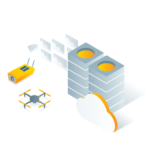
Capture
Collect terrestrial data using PIX4Dcatch and viDoc RTK rover and get measurements at centimetre-level absolute accuracy.
Capture drone data with the PIX4Dcapture Pro flight app.
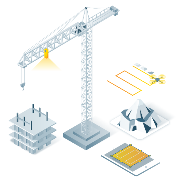
Process
Automatically process your images on the cloud using photogrammetry algorithms to transform them into measurable deliverables.
Generate accurate and georeferenced orthomosaics, 3D meshes, point clouds, and elevation models.
Analyse
Visualise, monitor and document site progress using an intuitive interface, a timeline, and built-in measurement tools, accessible online from any device or location, on a collaborative cloud-based platform.
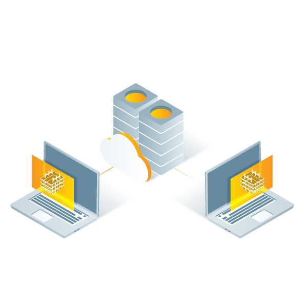
Share
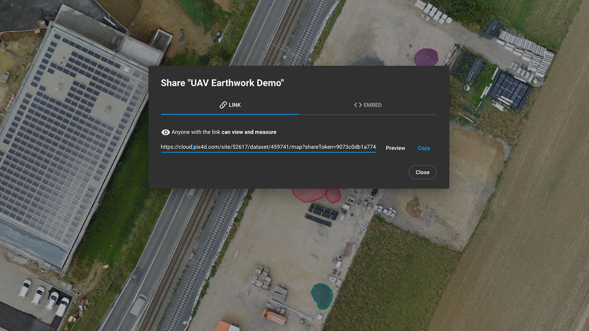
With a simple URL, share the results with your team or clients to ensure seamless information flow and greater collaboration.
Integrate
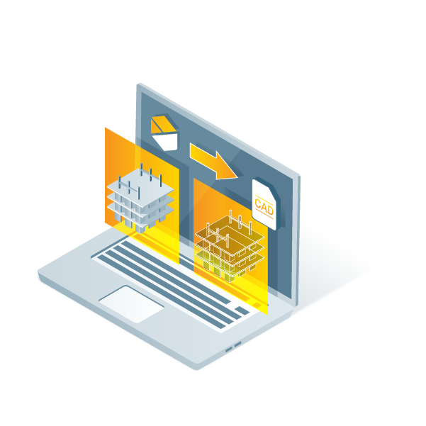
Import data to the Trimble Connect platform and/or download all outputs and export to other third-party CAD and BIM software for your next steps.
Professional photogrammetry on the cloud
Easy to useStart your new project in minutes. User-friendly platform with no previous training required.
Straightforward communication
Share your project status with team and stakeholders with the click of a button.
Up-to-date documentation
Keep a permanent and up-to-date record of the project and resolve disputes efficiently.
Map, measure, and document the progress of your site
Timeline analysis
Visual timeline of your jobsite for site tracking and project documentation
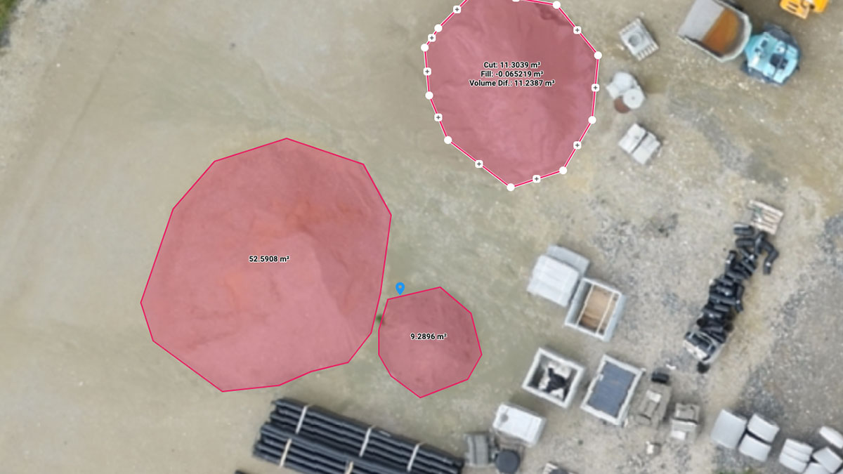
Calculate and compare volumes
Perform quick and precise volume calculations and compare them over time
Visualise your IFC files
Overlay your IFC files onto the 3D point cloud or mesh and get better visualisation of your project
Overlay design plans and maps
Compare the as-built with the as-designed to instantly verify site progress
Compare in 2D/3D over time
Compare two specific days to spot what has changed. Overlay your .dxf, .pdf or .ifc file on one side and your orthomosaic/3D point cloud/mesh on the other to get better visualisation of your progress
Virtual inspections
Remotely inspect any jobsite from any device or location, just with an internet connection
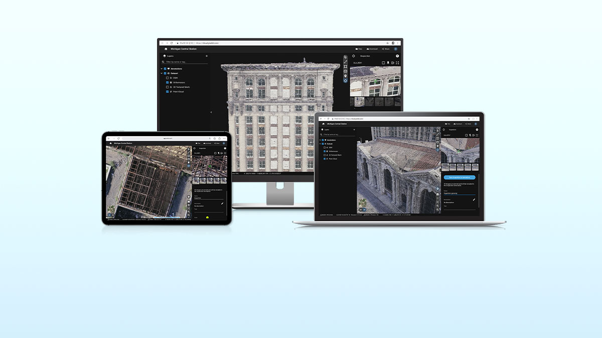
Measure, annotate and share
Measure distances, highlight critical elements and share data with your team, clients or stakeholders
Trimble Connect integration
Directly integrate your data to Trimble Connect for a seamless workflow
Monitor your projects online
Choose the right solution for your needsStandard
Create accurate 2D maps and 3D models from images
Measure distances, areas, and volumes
Add annotations
Generate elevation profiles
Perform virtual inspections
Share with team and stakeholders
Advanced
All Standard features, plus:
Track and document site progress with a visual Timeline
Compare volumes over time
Overlay design plans and maps
Compare two image maps to see what has changed
Improve collaboration with PDF reports
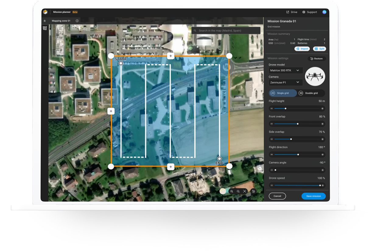
Cloud-based flight planning
A well-planned flight will save you time in the field and ensure quality results. You can plan your flight from the comfort of your office and download satellite or street view basemaps to work in the field with no internet connection. Take control of your data right from the start - plan your missions, download them, and fly with PIX4Dcapture Pro.
Related Products

DJI Mavic 3M Enterprise M..
£3,926.00 Ex Tax: £3,271.67
Pix4D Mapper
£304.62 Ex Tax: £253.85
Pix4D Survey
£210.73 Ex Tax: £175.61

Pix4D React
£47.27 Ex Tax: £39.39

Pix4D Matic
£346.58 Ex Tax: £288.82