


PIX4D Fields
- Brand: Pix4D
- Product Code: PIX4D Fields
- Availability: In Stock
-
£304.67
- Ex Tax:£253.89
Available Options
PIX4D Fields
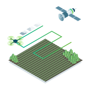
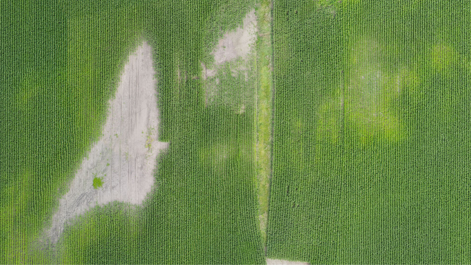
Advanced agriculture mapping software for aerial crop analysis and digital farmingRemote sensing
Collect images using a drone and any standard RGB or select multispectral cameras.
You can also use Satellite Data Import to enhance your mapping experience with Sentinel-2 satellite data.
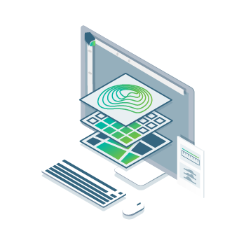
Process
Process imagery with the instant processing engine and get your maps directly in the field: 6.8 GB, 2948 images, 10 min (with the new radiometry module).

Scout
Generate precise orthomosaics, digital surface models, index maps, zones and accurate prescription maps.
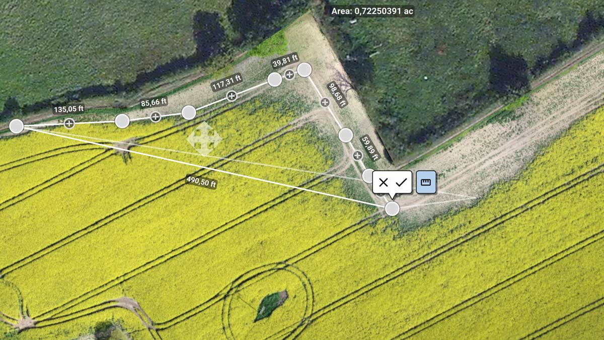
Trim your fields to a desired field boundary to create more targeted outputs.
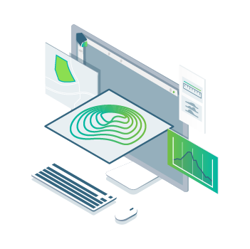
Analyse
Visualise and understand your crop growth stages and stress levels.
Analyse and compare different layers of information for a full insight of your yield performance and use them to increase crop production and reduce costs.
Share
Share your maps with all project stakeholders for seamless collaboration using PIX4D Fields' PDF report tool or using the share to PIX4D Cloud feature.

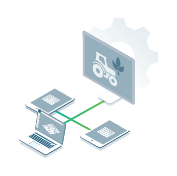
Integrate
Download all outputs, results and insights and import them into the Farming Management Software of your choice in various industry standard formats.
Create precision agriculture maps using images from drones and satellite.
The only hybrid mapping software solution for agriculture based on knowledge from farmers, agronomists, and researchers.
In-Field Results
Create maps rapidly (no internet connection required) for faster decision making and action, without leaving the field.
Accurate maps
Get maps of your fields and crops at any stage using satellite and/or drone imagery.
Trusted Results
Eliminate guesswork by analysing crop health maps and measure issues using calibrated multispectral or full resolution RGB images.
Easy Sharing
Share your data via PIX4Dcloud, as PDF report and in industry standard formats.
Use PIX4Dfields to create prescription maps and maximize crop yields
Create accurate field maps, generate insights and analyse field data in real time to increase crop productivity
Inspect, analyse and visualize your crop changes all year round
Fast processing - Accurate processing
Process imagery with the PIX4Dfields instant processing engine and achieve results in minutes in-office and in-field. No internet required.
Generate indices
Use the predefined list of agricultural indices or input your own custom index formula to understand your plant stress better.
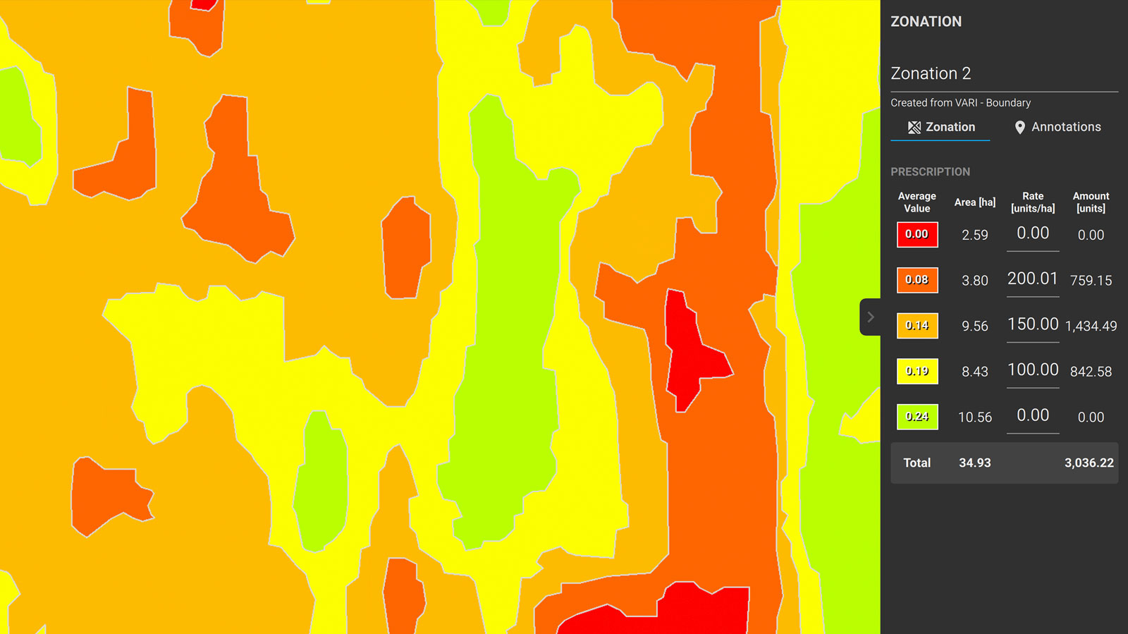
Zonate and prescribe
Aggregate the information from the vegetation index maps into zones and assign application rates.
Compare
Link different layers of information and compare your crop trends over time in a split or a double screen.
Measure and Annotate
Add annotations and measure important farm areas.
Calculate statistics
Calculate mean and standard deviation for DSM, index layers as well as for area annotations.
Export PDF report
Share your maps with all project stakeholders and team for seamless collaboration using PIX4Dfields PDF report tool.
Use aerial images to make the invisible, visible
Import images from any drone or satellite, captured with standard RGB or select multispectral cameras
Multispectral images
RGB cameras, drone images
Satellite images
Modified cameras and other cameras
Create and analyse real time maps of your crops to enhance your agriculture workflow
Easily scout your farm and generate the appropriate output for your needs
Orthomosaic
Field boundaries
Vegetation index map

Digital surface model
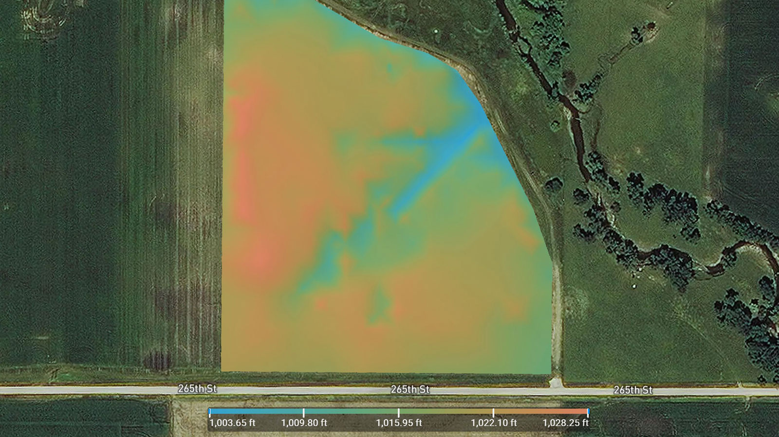
Zonation map
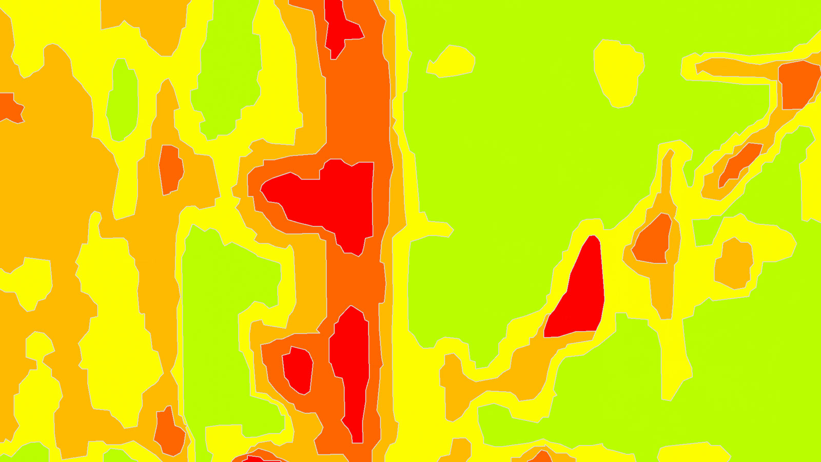
Prescription map
What's Included?
Desktop application with floating license (use on 1 device at a time).
Unlimited desktop processing and high-resolution outputs.
Personal support and upgrades included during your subscription from Pix4D.
What happens when I buy this product?
You will be sent your product key in .pdf format within 1 working day.
Where can I redeem my product key to start using Pix4D Fields?
You can redeem your key here: https://account.pix4d.com/redeem
You will need to have an account and be logged in.
What is Pix4D Fields?
Pix4D Fields is a product by Pix4D. An advanced agriculture mapping software for aerial crop analysis and digital farming.
How does Pix4D Fields work?
Pix4D Fields uses a direct-to-orthomosaic photogrammetry technique optimised for fast processing of smooth terrain from drone imagery. By focusing on this specific domain, Pix4D Fields provides high-quality maps processed in a fraction of the time, allowing immediate analysis while still on-site using a laptop computer.
Beginning with Pix4D Fields 1.11, an accurate processing option was introduced. This option generates a highly detailed height model along with a more accurate orthomosaic. However, the more complex processing algorithm will increase processing times. This is ideal for trial plots, spot application, and terrain analysis.
Does Pix4D Fields have access to satellite images?
Since Pix4D Fields 2.0 access to Sentinel 2 satellite is included.
Is Pix4D Fields available for macOS and Windows?
Yes, Pix4D Fields is available for both macOS and Windows.
How many computers can be used with the same account?
Each Pix4D Fields license is linked to a Pix4D account. Pix4D Fields can run on one computer at a time, but the license is floating and can be used to log in on any number of computers.
Are the inputs and outputs of Pix4D Fields compatible with other Pix4D software?
Yes, it is possible to import the exports from Pix4D Mapper (and other software) into Pix4D Fields and vice versa.
Can I use Pix4D Fields with no internet connection?
Yes, Pix4D Fields is specifically designed to convert images into high-resolution maps, with no cloud or internet connection required. However, note that before using it on a new computer you will need to activate your license. While connected to the internet, log into your Pix4D account and select a license so that you can use Pix4D Fields. The software will store this license on your computer until it expires, so you can work offline.
Which drones/cameras are supported in Pix4D Fields?
DJI:
Spark
Mini
Mavic Air
Mavic Air 2
Mavic Air 2S
Mavic Pro
Mavic 2 Enterprise Dual
Mavic 2 Pro
Mavic 2 Enterprise Advanced
Mavic 3
Mavic 3 Enterprise
Mavic 3 Multispectral
M30T
Phantom 3
Phantom 3 Adv
Phantom 3 Pro
Phantom 4
Phantom 4 Pro V2
Phantom 4 Pro
Phantom 4 RTK
Phantom 4 Multispectral
Zenmuse P1
Zenmuse H20T
Zenmuse X3
Zenmuse X5
Zenmuse X5RAW
Zenmuse X4S
Zenmuse X5S
Zenmuse X7
Yuneec:
E90
Parrot:
Anafi Ai
Anafi USA
Sequoia/Sequoia+
SlantRange:
SlantRange-3P
senseFly:
albris
S.O.D.A.
S110
senseFly Aeria X
Sentera:
Sentera 6X
AeroVironment:
Quantix
Autel:
Evo I
Evo II 8K
Evo II Pro 6K
Evo II Pro V3
Evo II Dual
MicaSense:
Altum
RedEdge-P
RedEdge
Sony:
Sony Alpha 7R IV
Skydio:
Skydio2/2+
Skydio X2(RGB only)
XAG:
M500
La Quinta:
DB2-Vision
ACSL:
SOTEN
Note: If an RGB or multispectral camera is not supported in Pix4D Fields, it is still possible to process the dataset if a file with the internal camera parameters is provided.
Are there any demo data sets I can use to test Pix4D Fields?
Yes, the example datasets can be downloaded from the dashboard once you have activated a license.
What hardware specifications do you need to run Pix4D Fields?
Operating system:
MacOS: Big Sur (11.0) or above.
Windows: Windows 10 (64 Bit) or above.
CPU & RAM
16 GB RAM (or more).
Quad-core or hexa-core Intel i5 (or faster), AMD Phenom processor (or faster).
Hard disk:
4GB HDD free space (more for large datasets).
SSD with 4x dataset size free space.
GPU:
Integrated or dedicated GPU with 2 GB RAM (GeForce GTX with 6GB RAM or better recommended for faster processing of data).
Display:
1024×768 display resolution (or higher).
Does Pix4D Fields support ground control points (GCPs)?
Pix4D Fields does not support ground control points (GCPs). If you need to use GCPs for improved accuracy and reconstruction, we recommend that you use Pix4D Mapper.
Can Pix4D Fields process oblique imagery?
Pix4D Fields supports processing nadir images captured with a drone camera pointing straight down. If you want to process oblique images, we recommend that you use Pix4D Mapper.
What is the recommended flight pattern?
For agriculture purposes, a single grid is recommended. We suggest avoiding double grid flights.
What is the recommended flight altitude in Pix4D Fields?
Assuming a relatively flat scene, a flight altitude between 60 and 100m normally gives good results. We do not recommend low-altitude flights (5-20m) as it may introduce artifacts into the orthomosaic. Please also keep in mind the legal flight altitude at your location.
My map doesn’t look great. Why?
The quality of your map can be affected by factors such as low overlap, reflective surfaces in the area (water or glass), or large areas of the same colour or texture (snow or sky).
Note: Pix4D Fields recommended side and frontal overlap is 80%. For forest, dense vegetation areas, it is recommended to increase the overlap to at least 85% frontal and side overlap and fly higher so that it is easier to detect similarities between overlapping images
What is the difference between a map generated in Pix4D Mapper and Pix4D Fields?
Pix4D Mapper takes fine-grained local variations in altitude into account when building maps, whereas Pix4D Fields is optimised for representing terrain, using a coarser ground model. If you have a lot of 3D structure in your maps, Pix4D Mapper will give more accurate results for the areas with the 3D structure. However, Pix4D Fields will still give good results on any surrounding terrain.
Beginning with Pix4D Fields 1.11, an accurate processing option was introduced. This option generates a highly detailed height model along with a more accurate orthomosaic. This is ideal for trial plots, spot applications, and terrain analysis.
Does Pix4D Fields include the same radiometric correction module as Pix4D Mapper?
Both products use the same radiometric correction module to correct individual input images. Pix4D Fields uses a different (faster) method to stitch the images into an orthomosaic. For more information: Radiometric correction in Pix4D Fields.
What is the geometric accuracy of Pix4D Fields?
It depends on the dataset, Pix4D Fields fast processing performs relatively well on the ground. However, on buildings and other structures above the ground, the accurate processing option is recommended. This option will generate a highly detailed height model along with a more accurate orthomosaic.
Absolute accuracy: On terrain features, the accuracy is 1-3 x the average GSD, or the GPS accuracy of the camera, whichever is larger.
Relative accuracy: On terrain features, the accuracy is 1-3 x the average GSD of the output orthomosaic.
What is the difference between the digital surface model (DSM) generated in Pix4D Fields and Pix4D Mapper?
While both digital surface models (DSMs) are outputs generated with Pix4D software, each is more specific to the industry the software is created for. With the DSM generated in Pix4D Mapper, you can get the accurate elevation value of each pixel, with or without above-ground objects, ready for your preferred GIS workflow. DSMs generated in Pix4D Fields capture terrain well but are less accurate in representing buildings and other vertical structures. They are a useful tool when addressing irrigation variability and pinpointing erosion-prone areas, but are not intended for high-resolution usage. The absolute altitude of the DSM generated in Pix4D Fields will depend on the quality of the GPS information from the image acquisition.
Does Pix4D Fields process thermal imagery?
Pix4D Fields can only process the thermal bands of the Micanse Altum and Sentera 6x cameras.
In zonation how do you decide if the zones are significantly different from each other?
Pix4D Fields automatically calculate the zones based on how many classes you select. The regions are based on clustering regions with similar values together.
What is the default coordinate system in Pix4D Fields?
The default coordinate system is the corresponding Universal Transverse Mercator (UTM) zone (datum WGS84).
Can I create a report of my outputs in Pix4D Fields?
You can create a PDF report of your outputs. To do so go to the export button in your top bar and once in the Export panel select the export type to be PDF report. Then include all the outputs you would like to display in the PDF report and hit export.
Can I upload Pix4D Fields layers to a farm management system?
It is possible to export zonation & prescription maps to a tractor terminal for variable rate fertilizer application as a shapefile.
Note: Pix4D Fields outputs such as Orthomosaics, Digital Surface Model, and Index maps are exported as a GeoTIFF file. Different Farm Management Systems support GeoTIFF files. Please refer to your Farm Management System about their supported formats.

DJI Mavic 3M Enterprise M..
Pix4D Mapper
Pix4D Survey

Pix4D React