


Parrot ANAFI Ai 4G Unlimited Transmission Range Includes Free Additional Battery!
- Brand: Parrot
- Product Code: ANAFI Ai
- Availability: In Stock
-
£4,200.00
- Ex Tax:£3,500.00
Available Options
Parrot ANAFI Ai 4G Unlimited Transmission Range Includes Free Additional Battery!
- Always connected, worldwide continuous connection to the Internet
- Seamless Wi-Fi to 4G switch: flies Beyond Visual Line of Sight and RC range
- Real time Low latency 1080p streaming
- In-flight cloud file transfer
- 3 axis 48 MP 4k 60 FPS camera with 6 x zoom
- Downward camera sensor and dual 296° pitch gimbal sensor cameras for parallax depth perception
ANAFI Ai is the first drone to use 4G as the main data link between the drone and the operator, which is a game changer for the drone industry. Users will no longer experience transmission limitations thanks to ANAFI Ai’s 4G connectivity, which enables precise control at any distance. For Beyond Visual Line of Sight flights, it stays connected even behind obstacles.
For the first time, ANAFI Ai embeds a Secure Element in the drone and in its Skycontroller 4. The 4G link between the drone and the user’s phone is encrypted. The Secure Element protects both the integrity of the software and the privacy of data transferred.
Parrot's large partner ecosystem delivers a wealth of specialised applications and services for a variety of professional uses. Parrot is the first in the industry to make its piloting application open-source. Parrot offers developers a Software Development Kit (SDK) to execute custom code in the ANAFI Ai drone during the flight. The SDK gives access to all flight sensors, including obstacle avoidance sensors, occupancy grid and internet access.
ANAFI Ai’s uniquely designed obstacle-avoidance (OA) system detects obstacles in all directions, using stereo cameras to sense objects and automatically avoid them.
ANAFI Ai incorporates a 48MP main camera and boasts a powerfully stabilised 4K 60fps / HDR10 camera to capture finely-detailed aerial images and smooth video footage. Originally the pioneer of consumer drones a decade ago, Parrot now seeks to set new standards for drones at work. Advanced artificial intelligence, autonomous flights, best-in-class imaging, photogrammetry accuracy and reliable 4G connectivity, put powerful new tools in the hands of professionals like never before.
4G connectivity
4G is profoundly changing the use cases for drones. With 4G, the data link between the drone and the pilot becomes robust in all circumstances. Already widely and reliably deployed around the world, 4G offers long range transmission at low frequency bands of 700MHz-900MHz.
Additionally the 4G connection means professionals can operate the drone at any distance. Many 4G operators offer quality-of-service guarantees for first responders, such as firefighters and police.
48MP imaging accuracy
ANAFI Ai's Quad Bayer sensor offers 14 EV of dynamic range in HDR10 mode. It catches all the details both in highlights and shadows.
Inspection professionals can use the 6 x digital zoom to observe 1 cm details at a distance of 75 m.
The controllable gimbal tilt range (from -90° to +90°) gives professionals access to complex points of view such as the underside of a bridge structure.
The hybrid image stabilization on 6 axis (3-axis mechanical, 3-axis electronic) ensures sharp photos even in crosswinds of up to 12.7m/s.
P-Log format allows professionals to retain more information with raw files.
Autonomous Photogrammetry
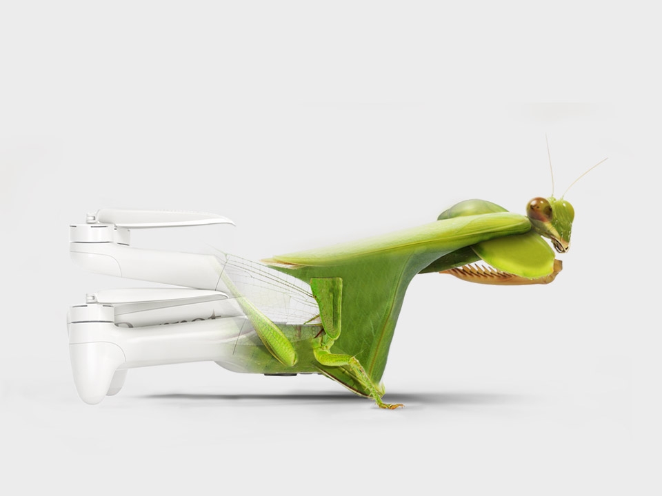
ANAFI Ai’s biomimetic form factor mimics nature's fitness. Its swivel head has an omni-directional camera, ensuring precise obstacle avoidance in every flight direction. When obstacles are detected, ANAFI Ai automatically determines the best trajectory to pursue its mission.
Embedded Artificial Intelligence allows for photogrammetry-specific flight plans to be performed automatically, optimising productivity and saving time. Professionals can generate optimised missions based on the land registry of the building selected in just one click.
ANAFI Ai’s Quad Bayer 48MP sensor delivers survey-grade accurate 2D and 3D models. It offers the same precision as drones with a 1" 20 MP sensor, while flying 1.5 times higher. A GSD of 0.46 cm/px is obtained at an altitude of 30 m. Pictures can be captured at 1 fps, 2x faster than any other drone in the market.
ANAFI Ai images are compatible with all photogrammetry software suites. With PIX4D, the market leader in photogrammetry software, Parrot has pushed the integration one step further. During the flight, ANAFI Ai sends the pictures to PIX4D cloud directly. Computation starts when the drone lands so that professionals gain productivity by avoiding manual time-consuming data transfer.
1-Click flight plan creation
A click on FreeFlight 3D interactive map is all it takes to generate a quick building scanning. Artificial Intelligence automatically defines optimum flight parameters and trajectory. The 48 MP images precisely geotagged by ANAFI Ai sensors (IMU, GNSS & Time of Flight) allow an accurate 3D reconstruction.
FreeFlight 7’s mapping background comes from ArcGIS. 3D buildings representation is based on OpenStreetMap data, which covers cities all over the world.
A unique robotic platform
Since the first Parrot A.R. Drone in 2010, open-source is at the heart of Parrot platforms. Parrot continually contributes to the open-source community.
With the launch of ANAFI Ai, Parrot expands its Software Development Kit (SDK) by open-sourcing the 7th version of its FreeFlight ground control station application:
Air SDK: provides a breakthrough technological architecture to run code directly on ANAFI Ai. Developers can program custom-designed autonomous flight missions by accessing all drone sensors, connectivity interfaces, and autopilot features.
Ground SDK: allows developers to create iOS and Android mobile applications for Parrot drones. All the features of the drone (control, video, settings) are accessible.
Please note: FreeFlight 7 is NOT compatible with any Android devices, only iOS
OpenFlight: the open-source core of FreeFlight 7 application. Developers can focus on adding their own features and immediately get a professional looking App ready to be published on the app stores.
Sphinx: enables developers to test their algorithm and flight strategy in a photorealistic 3D simulation environment running through Unreal Engine, with accurate physical interaction.
Parrot’s industry-leading SDK facilitates the implementation of tailored end-to-end solutions for professionals from public safety, search & rescue to defence and inspection fields.
Parrot platforms are built on industry standards (WIFI, RTP/RTSP, MAVLINK), making interoperability much easier.
Parrot keeps on expanding its mature software ecosystem:
From enterprise drone platforms (Skyward, a Verizon Company, Measure, an AgEagle Company)
Flight logs services (DroneLogbook, Airdata)
Public safety programs (DroneSense)
Advanced mission planning (QGroundControl, UgCS)
Media and data cloud platforms (Survae)
Real time geospatial situational awareness (Rapid Imaging, Textron Systems)
Surveying and mapping (PIX4D)
Today Parrot has the largest partner ecosystem for professional drones.
Lens:
The ANAFI Ai lens is specifically designed for Parrot. It integrates 6 aspherical elements and has been optimised for low optical flare.
This lens gives a 68° HFoV in Standard video mode, and a 64.6° HFoV in Standard photo mode.
Occupancy grid
The depth information from the stereo and monocular perception algorithms is integrated into an occupancy grid. This grid discretizes the 3D surrounding environment into 3D cubes, called voxels. To each voxel is attributed a probability to be occupied by an obstacle or, on the contrary, to be free of obstacle.
A raycasting algorithm is used to integrate the depth information into the occupancy grid. For each pixel of the depth map generated by the depth from stereo matching, converted into a 3D point, and for each point of the point cloud from the depth from motion:
A ray is cast in the occupancy grid, from the position of the perception system, to the position of the 3D point.
The probability of occupation of the voxel containing the 3D point is increased
The probability of occupation of all the voxels crossed by the ray -except the one containing the 3D point- is decreased
Cybersecurity by design
Pioneering flight, Parrot is also pioneering security.
ANAFI Ai embeds a WISeKey Secure Element which is NIST FIPS140-2 Level 3 compliant and Common Criteria EAL5+ certified.
The Secure Element: Performs cryptographic operations.
Stores and protects sensitive information.
Protects the integrity of the embedded software.
Provides a unique identity to the drone for 4G pairing and strong authentication.
Features a unique digital signing of the pictures taken by the drone.
Users have full control over their data. No data is shared by default without the user’s express consent. ANAFI Ai is compliant with the European Union General Data Protection Regulation (GDPR) and in some cases goes even further. For example, users can delete all data with 1-Click, easily maintaining control over what is stored.
A bug bounty program is currently running in partnership with YesWeHack, the first European crowdsourced security platform. Parrot benefits from their vast community of cybersecurity researchers to identify potential vulnerabilities in its drones, mobile applications and WebServices.
A cool drone By its design, Parrot’s new Skycontroller 4 is a milestone for the industry. Cumbersome cables are no longer required and it enables the use of an iPad mini and all large smartphones. The controller also features an HDMI output, which allows streaming videos from ANAFI Ai. With ANAFI Ai, Parrot believes “pleasure in the job puts perfection in the work” - Aristotle. ANAFI Ai is Parrot’s new cool drone: it looks nice, it is intriguing, foldable, operational in 1 minute and resistant to rain.
What's Included?
ANAFI Ai Drone x 1
Smart Batteries x 2 (1 extra free!)
Hard Carrying Case x 1
Protective Gimbal Cover x 1
Skycontroller 4 Remote Controller x 1
Propellers x 8
USB-PD Twin Charger x 1
USB-C to Lightning Cable for Apple Device x 1
USB-C to USB-C Cable to charge batteries x 2
Set of spare Joysticks x 1
Calibration Chart x 1
Guide Documents x 2
Leicester Drones is an authorised retailer of Parrot Drones
How do I use 4G with the ANAFI Ai?
How does the ANAFI Ai's cybersecurity work?
ANAFI Ai's SDK Is opensource, How do developers create software for the Ai?
You can learn everything you need to know here
You can also find software for the ANAFI Ai on Github here
Parrot Anafi Ai - Cameraman mode
Parrot ANAFI Ai First Flight
Parrot ANAFI Ai - Charging
Parrot ANAFI Ai - Flight Plan mode
Parrot ANAFI Ai - Freeflight 7 and Parrot Cloud
Parrot ANAFI Ai - Freeflight 7 Walkthrough
Parrot ANAFI Ai - Photogrammetry
Parrot ANAFI Ai - Touch and Fly
Parrot ANAFI Ai - Vehicle Mission
Parrot ANAFI Ai - Flight Preparation
ANAFI Ai Tutorial - Remote ID
ANAFI Ai Tutorial - Reset
| Aircraft | |
| IP Rating: | IP53 |
| Max Service Ceiling Above Sea Level: | 5000 m |
| Satellite Systems: | GPS, Glonass and Galileo |
| Weight: | 898 g |
| Max Speed: | Horizontal: 16 m/s Vertical: 4 m/s |
| Ports: | MicroSD and SIM card slots |
| Operating Temperature: | -10°C to 40°C |
| Propeller Speed: | Max: 10,000 rpm |
| Wind Resistance: | 12.7 m/s |
| Sensors: | Vertical camera & Time of Flight. Barometer and magnetometer. 2 x 6-axis inertial units (flight and camera). 2 x 3-axis accelerometers. 2 x 3-axis gyroscopes. Stereoscopic cameras mounted on a 311° rotating gimbal. AI trajectory optimization system. |
| Dimensions: | Folded: 30.4 x 13 x 11.8 cm Unfolded: 32 x 44 x 11.8 cm |
| Max Flight Time: | 32 mins |
| Cybersecurity: | Zero data shared without user consent. FIPS140-2 compliant and CC EAL5+ certified Secure Elements. Strong authentication for 4GDigitally signed pictures. Transparency and Bug bounty continuous security check. |
| SDK: | Air SDK: onboard coding capabilities. Ground SDK: iOS & Android App development kit. OpenFlight: open-source core of Free-Flight. 7Sphinx: 3D photorealistic simulator. Olympe: Python controller programming interface. PDrAW: video & metadata tools |
| Remote Controller | |
| Connection Types: | Seamless 4G/Wi-Fi switching Flies Beyond Visual Line Of Sight. 1080 p 30 fps live streaming. No interference near telecom towers |
| Video Transmission: | 1080 p |
| Weight: | 606 g |
| Operating Frequency: | 2.4 GHz – 5 GHz |
| Battery: | 3.350 mAh 7.2 V Charges smartphones and tablets |
| Transmission System: | Wi-Fi 802.11a/b/g/n & 4G |
| Ports: | 2 x USB-C (charging and connec-ting), micro-HDMI Dust resistant (IP5X) |
| Battery | |
| Capacity: | 6800 mAh 4.4 V |
| Charge Rate: | 45 W |
| Type: | High Density Lithium Polymer (262 Wh / kg) |
| Weight: | 366 g |
| Charging Port: | USB - C |
| Drone | |
| Deploy Time: | 60 seconds |
| Camera | |
| Max Video Bitrate: | 200 mb/s |
| Photo Formats: | Formats: JPEG, DNG RAW |
| Photo Resolutions: | Resolution: 48 MP (8000x6000), 12 MP (4000x3000) |
| Video Formats: | MP4 (H.264, H.265) with P-Log for professional video editing |
| Video Resolution: | 4K UHD: 3840x2160 1080 p: 1920x1080 |
| Zoom: | 6x – lossless: up to 4x (1080p) & 2x (4K UHD) |
| Sensor: | Sensor: 1/2’’ 48MP CMOS |
| Dynamic Range: | 14 EV in HDR mode |
| ISO Range: | 50 to 6400 |
| Optical LD-ASPH: | low dispersion aspheric lens: Aperture : f/2.035. mm focal equivalent: 24 mm |
| Shutter Speed: | 1/15 s to 1/10000 s |
| Depth of Field: | 4.5 m to ∞ |
| Photo Modes: | Single, Bracketing, Burst (10 fps), Panorama (4 formats), Time-lapse, GPS-lapse |
| Photo FOV: | Horizontal field of view (HFOV): 73° (Wide). 69° (Wide with EIS). 65° (Rectilinear with EIS) |
| FOV (Field Of View): | Horizontal field of view (HFOV): 68° |
| Frame Rate: | 4K UHD: 24/25/30/48/50/60 fps. 1080 p: 24/25/30/48/50/60/90/100/120 fps. HDR 10: 4K UHD/1080p - 24/25/30 fps. HDR 8: for all resolutions. |
| Gimbal | |
| Controllable Range: | Tilt: -90° to +90° |
| Stabilisation: | Mechanical: 3-axis (pitch, roll, yaw) Electronic (EIS): 3-axis (pitch, roll, yaw) |
| App / Live View | |
| Mobile App: | PARROT FREEFLIGHT 7 Free App for Apple (iOS) devices. FREEFLIGHT 7 is not compatible with any Android devices and so the ANAFI Ai is not compatible with Android devices |
| Autonomous Flight | |
| Photogrammetry: | Single grid, double grid, orbit |
| Flight Plan: | Multiple Waypoints and Points Of Interest |
| Camera Operator: | Automatic framing with visual tracking |
| RTH: | Customisable return altitude |
| Vehicle: | Flight adapted to controller location reference |

Parrot ANAFI USA 3 Cam Th..

A2 Certificate of Compete..

Parrot ANAFI Ai Smart Bat..

DJI M30 Foldable IP55 48M..

DJI Matrice 30T IP55 Ther..
Pix4D Mapper
Pix4D Survey